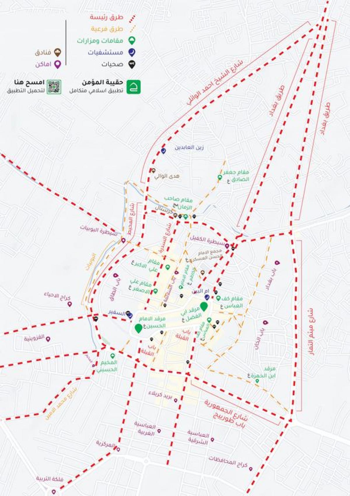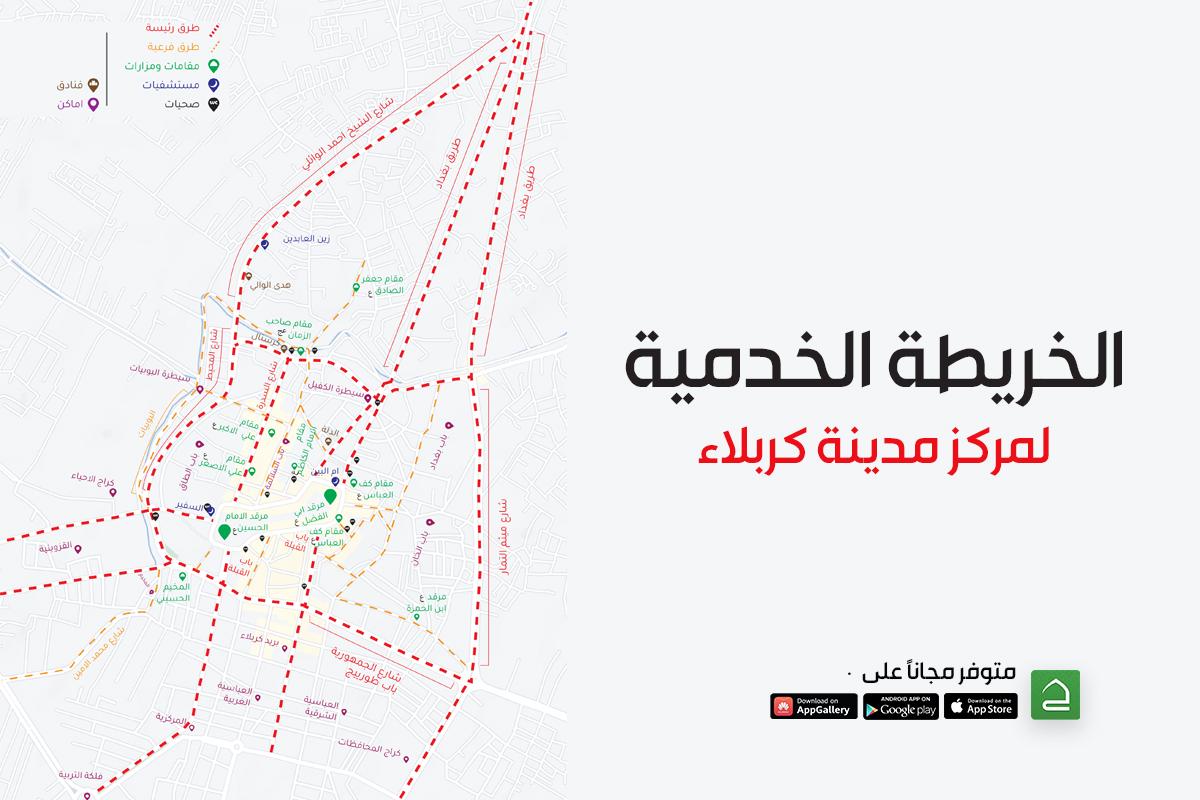
The supervisor of this work and the official of the center, Sayed. Ali al-Jayashi, told Al-Kafeel Network, "This service is one of a series of electronic services and updates launched in conjunction with the Ziyarat Arba'een, investing in cyberspace and smart device technologies to develop this service."
He added: "This map will provide a service for visitors, especially those who are on foot. And in a geographical statistical precedent comprehensive for most of the public services, for the main roads leading to the holy city of Karbala and the important places in it with precise locational accuracy, this map is considered one of the most important maps developed for the province of Karbala according to realistic geographical measurements. It has a beautiful design and an uncomplicated concept.”
To view and download the map, click here.