
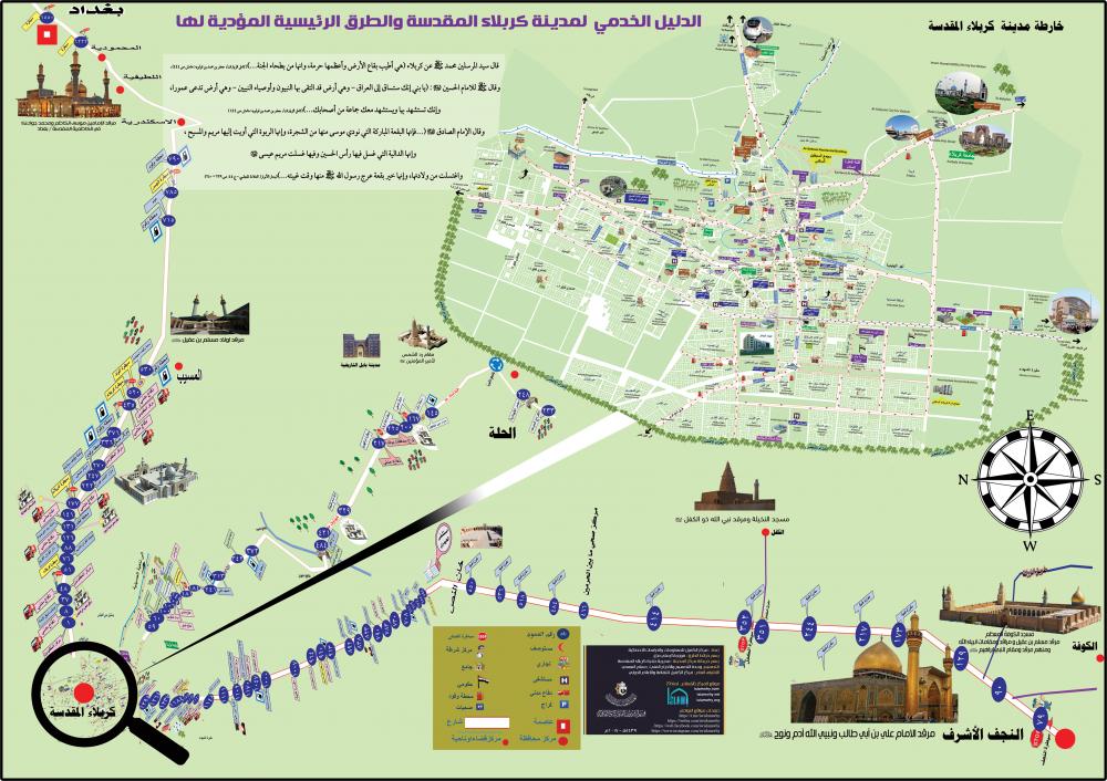
Al-Kafeel Center for Information and Statistical Studies at the al-Abbas's (p) holy shrine has completed service maps for these roads.
The director of the Center; Mr. Jassam Mohammad al-Sa'idi has added: "We have shown on the maps health centers, civil defense, temporary parking lots, visitors' cities, centers for the lost and missing and the main service centers, according to the column numbers on these roads, to facilitate the access to them for any visitor."
Al-Sa'idi explained: "The map of the holy city of Karbala, which was annexed by the Directorate of the holy Karbala after being translated into English, was added to it."
Adding: "All these information were gathered in a single map in accordance with realistic geographical measurements in an elegant design and under the supervision of the al-Kafeel center for culture and international media at the holy shrine, which, in coordination with the Internet Division, put the map on the smartphone application "Haqeebatul Mu'min" in its new update launched recently.
To view and download the map,please click here.